News and Resource Centre
Our work with Equatorial Launch Australia (ELA)
Our work with Koala Conservation Australia (KCA)
Our work with Australian Wildlife Conservancy (AWC)
Our work with Equatorial Launch Australia (ELA)
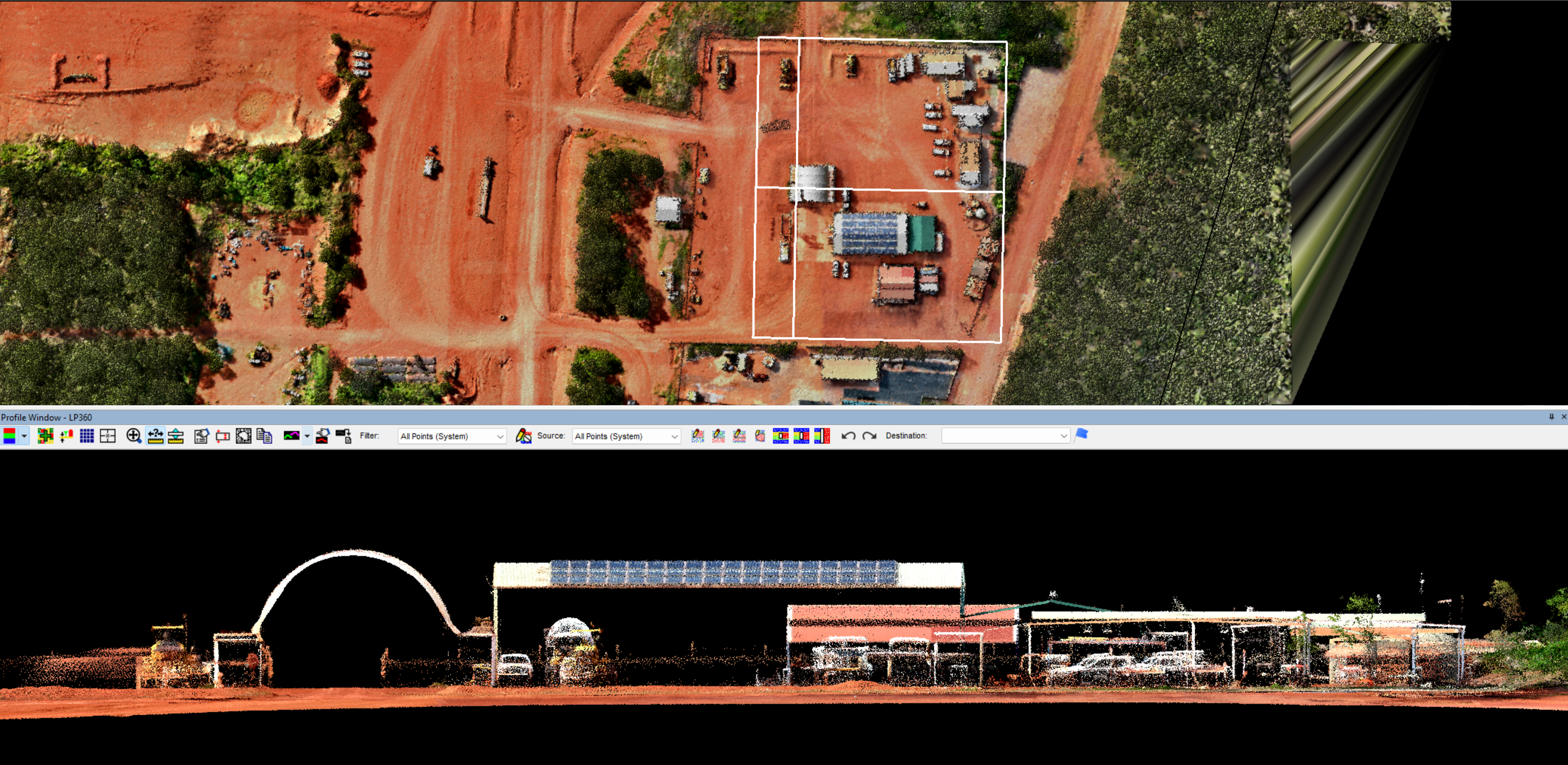
High up in the northernmost reaches of the Northern Territory, Equatorial Launch Australia (ELA) is shaping Australia’s space future with the development of a world-class spaceport. Located in Nhulunbuy on the Gove Peninsula, this remote region presents logistical and environmental challenges, requiring precision, accuracy, and innovative data solutions. J2 Geospatial Intelligence Services was the natural choice to deliver the high-resolution LiDAR mapping essential for site planning, infrastructure development, and environmental management.
High-Resolution LiDAR for Precision Decision-Making
To support ELA’s expansion, J2 deployed aerial LiDAR, capturing an exceptionally detailed dataset that exceeded initial project requirements.
✅ Colourised LiDAR with ~700 points per square metre (LAS format)
✅ 10cm Digital Elevation Model (DEM) of bare earth (raster GeoTIFF)
✅ 10cm gridded LiDAR of bare earth (LAS format)
✅ 3D contour mapping with 25cm intermediate and 1m index contours
✅ 6cm Ground Sampling Distance (GSD) Orthomosaic imagery
✅ Hypsometrically tinted hillshade map for enhanced visualisation
Delivering More Than Expected
While the project scope initially covered 5.53 km² (553 ha), J2 applied a buffer margin, ultimately capturing 6.56 km² (656 ha) to provide greater coverage and context for analysis.
Supporting Australia’s Space Industry with Geospatial Intelligence
This high-fidelity terrain data enabled ELA to:
- Optimise launch site layout with precise topographical insights
- Improve infrastructure planning for roads, launch pads, and support facilities
- Enhance environmental assessments with highly detailed elevation data
- Strengthen risk assessments by identifying potential hazards early
J2 is proud to contribute to Australia’s growing space industry, delivering the geospatial intelligence required for informed decision-making in remote and complex environments. As ELA continues to expand its operations, we look forward to further collaborations supporting Australia’s sovereign space capability.
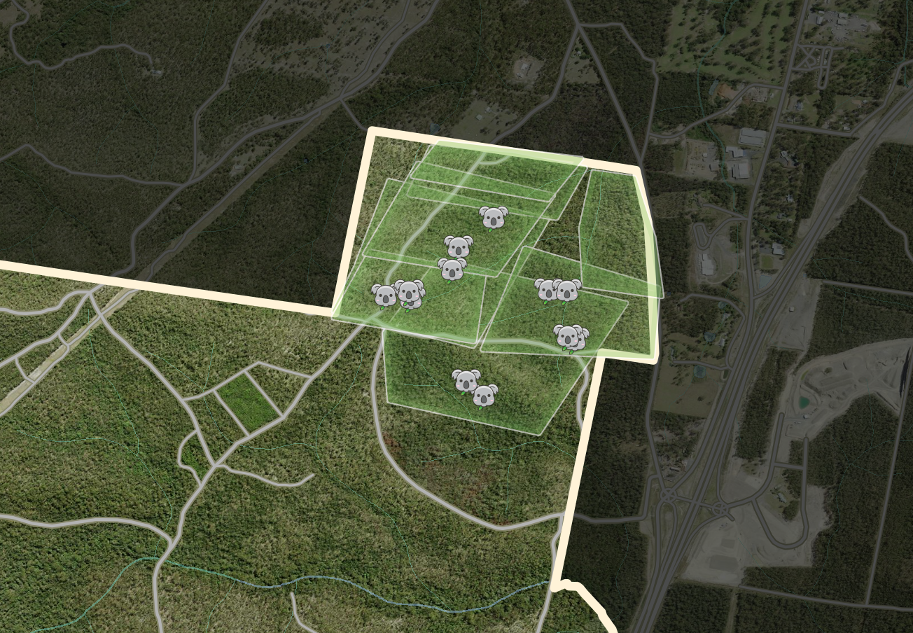
Our work with Koala Conservation Australia (KCA)
Koalas are an iconic yet vulnerable species, facing increasing threats from habitat loss, disease, and environmental changes. Koala Conservation Australia (KCA) is dedicated to protecting, rehabilitating, and researching koala populations to ensure their survival for future generations.
J2 Geospatial Intelligence Services is proud to collaborate with KCA, leveraging our advanced aerial sensing technology to support koala surveys and health assessments. Though this work has meant late nights and early mornings for our operational team, it has been a thoroughly rewarding experience. The dedication and passion of KCA inspire us every day, and we are honoured to contribute to their vital conservation efforts.
Advancing Koala Conservation with Thermal Aerial Sensing
Traditional koala surveying methods, such as ground-based observations, can be labour-intensive and limited in coverage. To enhance data collection and efficiency, J2 employed radiometric thermal aerial sensing, enabling KCA to:
✅ Identify koalas in dense forested areas with thermal and multispectral imaging
✅ Monitor koala populations efficiently over large and remote areas
✅ Integrate aerial and ground-based survey data for a comprehensive habitat analysis
Data-Driven Conservation for a Sustainable Future
By combining geospatial intelligence with KCA’s on-the-ground expertise, this project provided detailed insights into koala habitats, population health, and conservation needs. The data significantly improved KCA’s ability to:
- Implement targeted conservation efforts
- Develop more effective habitat management strategies
- Support long-term sustainability of koala populations
We look forward to building a continued successful partnership with Koala Conservation Australia, ensuring the health and longevity of koala populations for generations to come.
Our work with Australian Wildlife Conservancy (AWC)
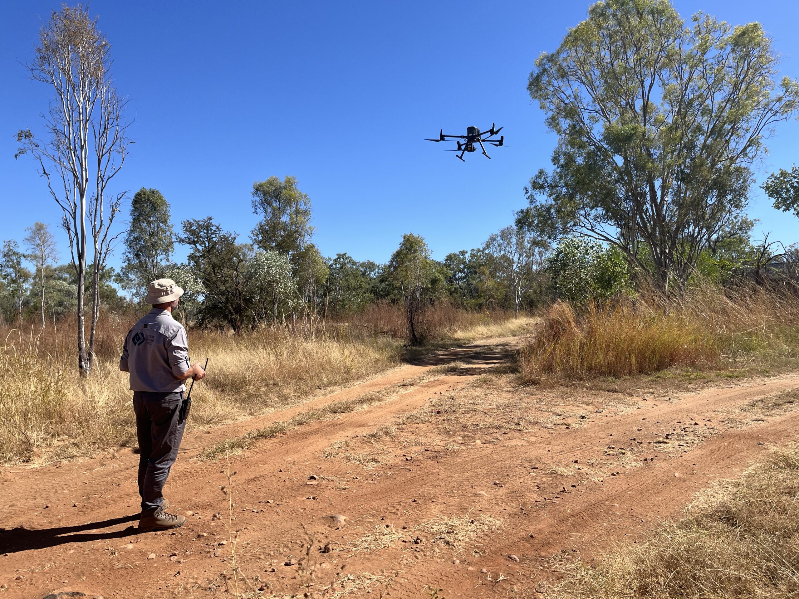
In January 2023, Mornington Wildlife Sanctuary, located in the central Kimberley region of Western Australia, experienced unprecedented flooding due to heavy rainfall from ex-Tropical Cyclone Ellie. The deluge caused significant damage to infrastructure, research facilities, and years of valuable ecological data. In response, J2 Geospatial Intelligence Services partnered with the Australian Wildlife Conservancy (AWC) to support the sanctuary’s restoration efforts through advanced geospatial mapping.
Deploying Advanced Geospatial Technology
Leveraging our expertise in aerial photogrammetry and LiDAR surveys, J2 conducted comprehensive topographical analyses of the affected areas. Our team utilised a fleet of advanced aerial drones and ground-based sensors to capture high-resolution data, enabling the creation of precise 3D models and maps of the flood-impacted zones.
Informing Resilient Reconstruction
The detailed geospatial data provided by J2 has been instrumental in informing AWC’s reconstruction plans. By understanding the flood dynamics and terrain alterations, AWC can make informed decisions to restore infrastructure and implement measures to enhance the sanctuary’s resilience against future natural disasters.
A Partnership for Conservation and Community
This collaboration underscores the value of engaging with social enterprises like J2. As a social enterprise of the veteran-led non-profit Disaster Relief Australia (DRA), every dollar earned from this project helps deploy DRA volunteers to communities in need during future disasters. We are proud to contribute to the conservation of Australia’s unique wildlife while supporting broader community resilience initiatives.
Industry Associations and Accreditations
Australian Association for Uncrewed Systems (AAUS)
Geospatial Council of Australia (GCA)
Pacific GIS & Remote Sensing Council (PGRSC)
The Good Market
Australian Association for Uncrewed Systems (AAUS)
The Australian Association for Uncrewed Systems (AAUS) is the leading industry body for uncrewed and autonomous systems in Australia. It advocates for the responsible integration of drones, robotics, and automated technologies, providing policy support, industry engagement, and professional development.
Geospatial Council of Australia (GCA)
The Geospatial Council of Australia (GCA) is the peak body representing Australia’s geospatial sector. It supports professionals working in surveying, spatial sciences, and location intelligence, promoting industry standards, professional development, and innovation in geospatial technologies.
Pacific GIS & Remote Sensing Council (PGRSC)
The Pacific GIS & Remote Sensing Council (PGRSC) facilitates regional collaboration and capacity-building in geospatial and remote sensing technologies across the Pacific. It connects industry professionals, government agencies, and academic institutions to advance the use of geospatial data for sustainable development.
The Good Market
As a social enterprise, J2 is a certified member of the Good Market – a global platform that connects purpose-driven businesses and organisations committed to ethical, sustainable, and socially responsible practices. It provides visibility and networking opportunities for enterprises that prioritise positive environmental and social impact.