Technology and platforms
J2 deploys the latest in drone technology and advanced software, complemented by AI-supported tools for efficient large-scale analysis. This combination of cutting-edge technology and expert analytical skills ensures thorough and precise geospatial intelligence products.
Drones
Aerial sensors
Ground sensors
Intelligent software
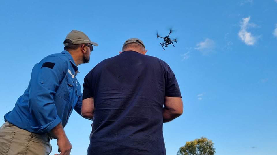
Our people
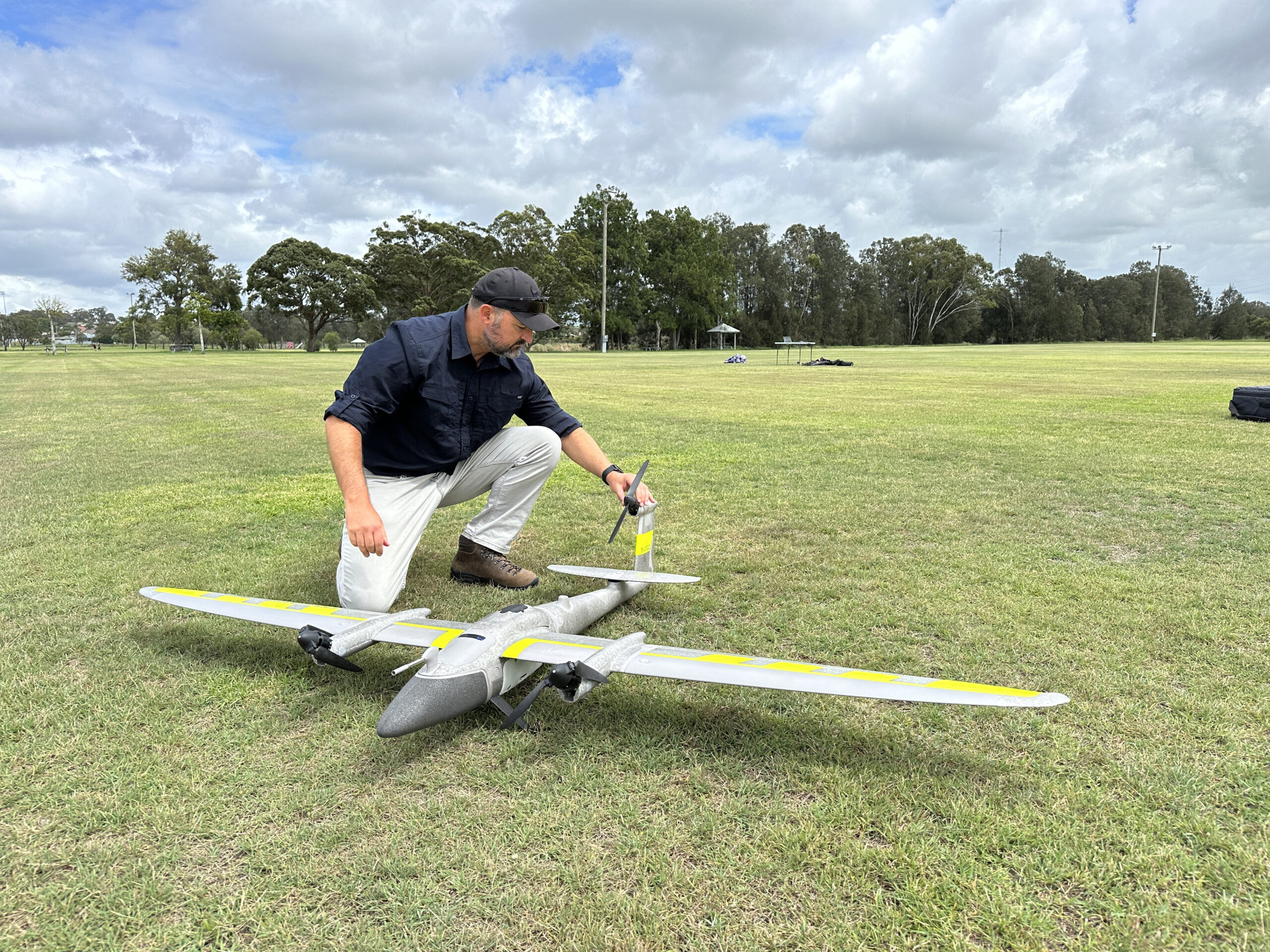
Drones
J2 has invested heavily to field a fleet of industry-leading mapping and surveying drones.
Our flagship is the Quantum Systems, Trinity Pro electric vertical-take-off and landing drone. This European manufactured drone can utilise numerous sensor-packages, is not restricted by runway requirements, yet still can cover large areas as a fixed-wing platform.
Our DJI Matrice 350 RTK is our workhorse enterprise RPAS solution. A new evolution of the Matrice 300 RTK platform, the M350 can be operated without compromise, featuring a comprehensive, end-to-end hardware-software ecosystem that is suitable for countless applications across industries.
Our DJI Mavic 3 Suite utilise the beloved form factor of the DJI Mavic 3 camera drone to provide a compact, industry-leading enterprise solution for its weight class. The perfect tool for a variety of applications, the DJI M3E/T/M and their various sensors can be used for a myriad of tasks and is a truly cost-effective platform with plenty of capability.
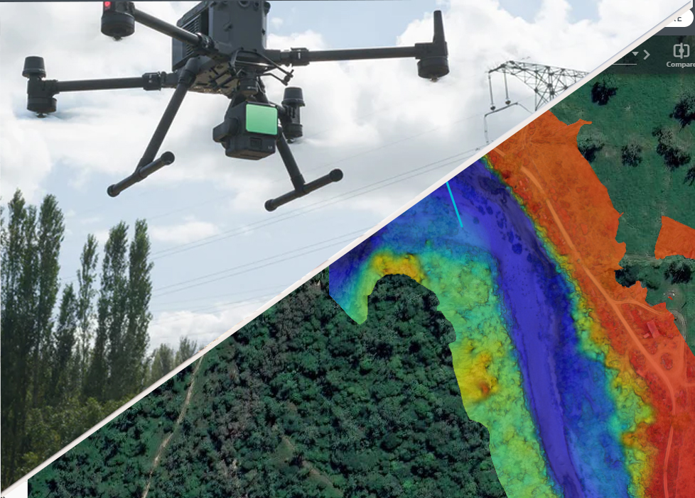
Aerial sensors
Our drones support a wide array of sensor payloads rarely offered all by the same service- supplier
LiDAR
- LiDAR technology is an ideal solution for examining the surface of the earth, assessing information about the ground surface, creating a digital twin of an object, or detailing a range of geospatial information. Laser scanning systems harness this technology, using Lidar data to map 3D models and digital elevation.
Multispectral Cameras
- Integrated camera system fitted with 1 colour and 4 multispectral cameras (green, red, red edge, and near infrared). Enables applications such as high-precision aerial surveying, crop monitoring and natural resource surveys.
RGB
- Colour cameras up to 61MP, allow for extremely detailed mapping and digital visualisations via our photogrammetry and visualisation software.
Ground sensors
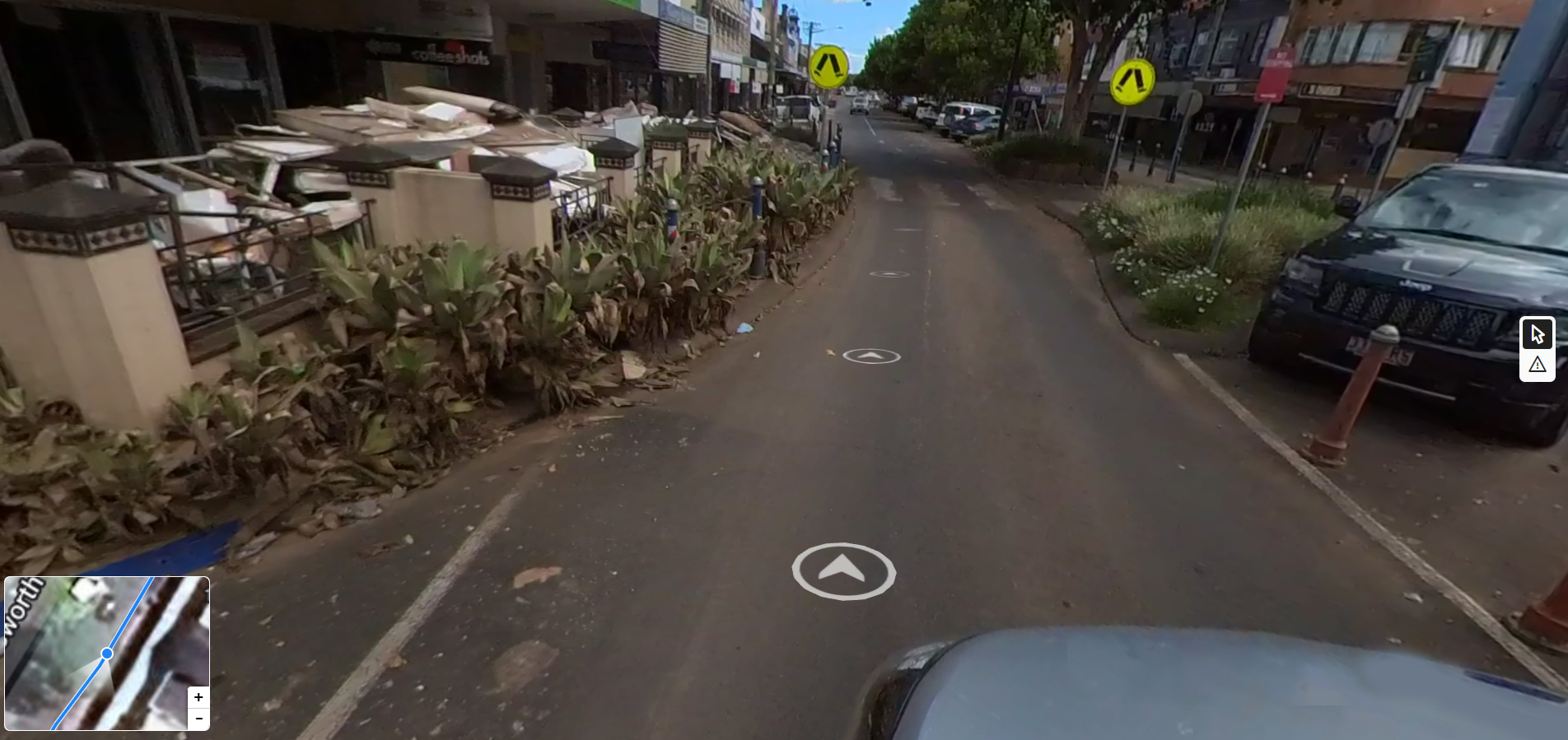
Streetview imagery
Construction progress monitoring
Live information feed
J2’s ground-based sensor services offer an innovative perspective in data collection. Utilising 360-degree sensors mounted on personnel or vehicles, we create detailed ‘streetview’ products, essential for accurate, on-the-ground insights. J2’s ground imaging complements aerial drone data, enabling us to craft multi-level maps that effectively track construction progress, environmental changes, and more. This approach is particularly invaluable for conducting thorough damage assessments in post-disaster scenarios, providing a comprehensive view of affected areas.
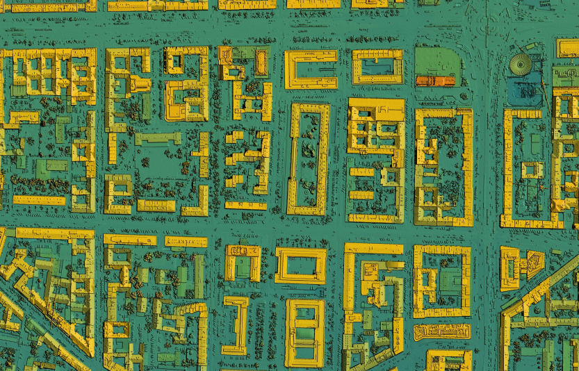
Intelligent software
Advanced Safety Management Software Ensuring Regulatory Compliance
Advanced Analysis Tools Including Multi-level Image Generation
Volumetric Data Analysis
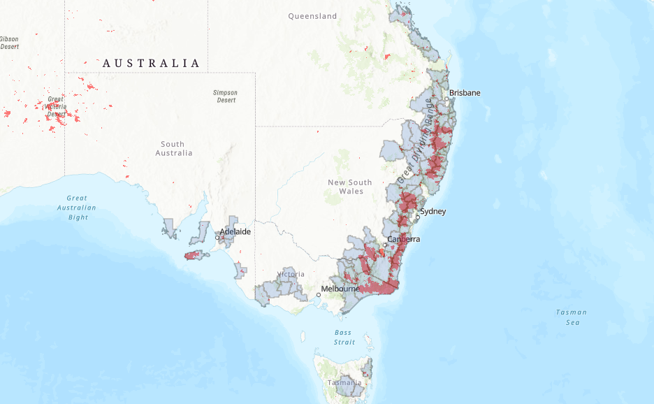
Geographic Information Systems
J2 takes pride in their commitment to excellence and precision in drone and geospatial operations, leveraging industry-leading software for both flight management and the seamless processing and presentation of data. By harnessing cutting-edge technology, the J2 team ensures that every aspect of operations is conducted with efficiency and accuracy, allowing the team to deliver top-tier results to J2’s clients. This dedication to utilising the best-in-class software underscores J2’s commitment to staying at the forefront of the industry, providing innovative solutions, and consistently exceeding expectations.
Hardware must be complimented by quality software to effectively process data. J2 employs an incredibly capable and complimentary array of software packages in support of intelligence products.
Our people
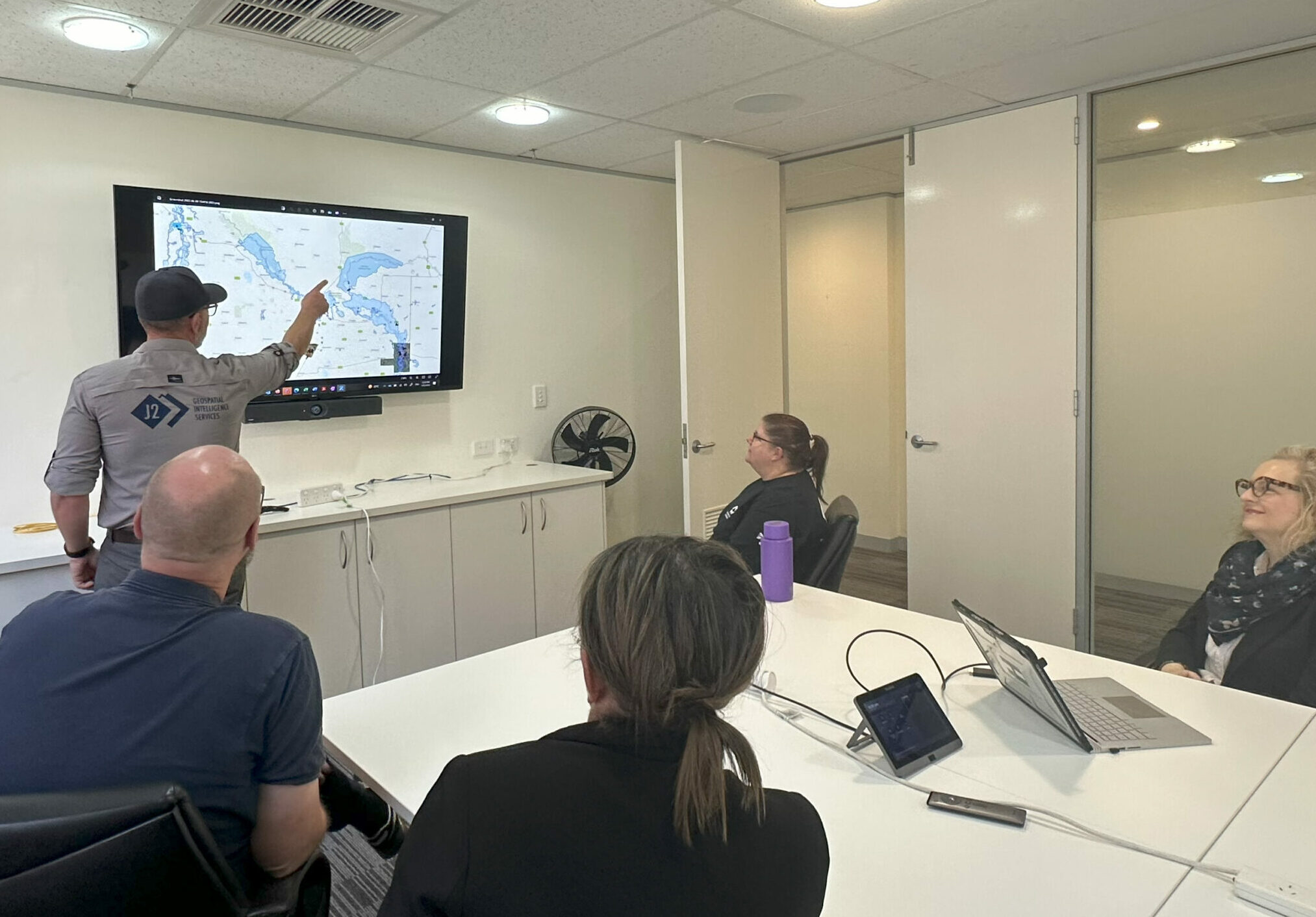
Ultimately it is the calibre and quality of our people that is the truly discriminating element of services J2 offers. the J2 team are a tenacious, values-driven crew that is obsessed with precision and providing a service that generates insight and impact.
Explore J2
Learn more and explore J2’s services and capabilities with the links below.